General Description
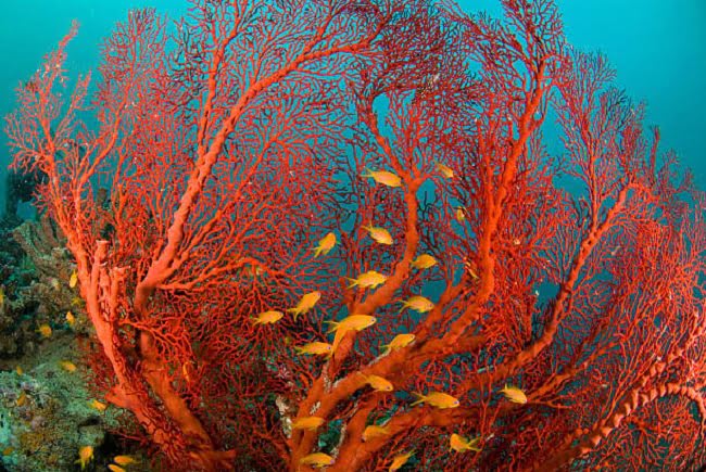
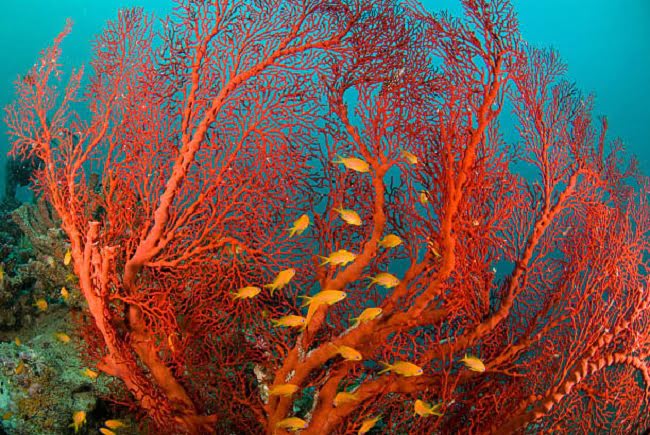
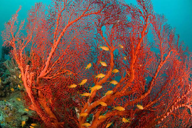
South Gorgonian Reef, called so due to the strong concentration of gorgonians along the entire wall, is an isolated madreporic atoll with an elongated shape facing north-south and is located about 3 kilometers south of the island of Marmar. Indicated in Arabic with the name of Shabrur, a term is used to indicate the reefs with the top submerged under the surface.
Distance from the coast: 57 kilometers
External site: isolated submerged reef
Current: average probability
Visibility: from good to excellent
Submerged site: medium, elongated plateau
Difficulty: medium, demanding
Beginning of the dive: in the madreporic plateau
Pelagic interest: grape coral, gorgonians
Pelagic: sharks, barracudas, trevally
Average and max depth: from 25 to 40 m
Night: no diving is allowed at night
Best time: morning till the central hours
Snorkeling: along the wall
Diving:
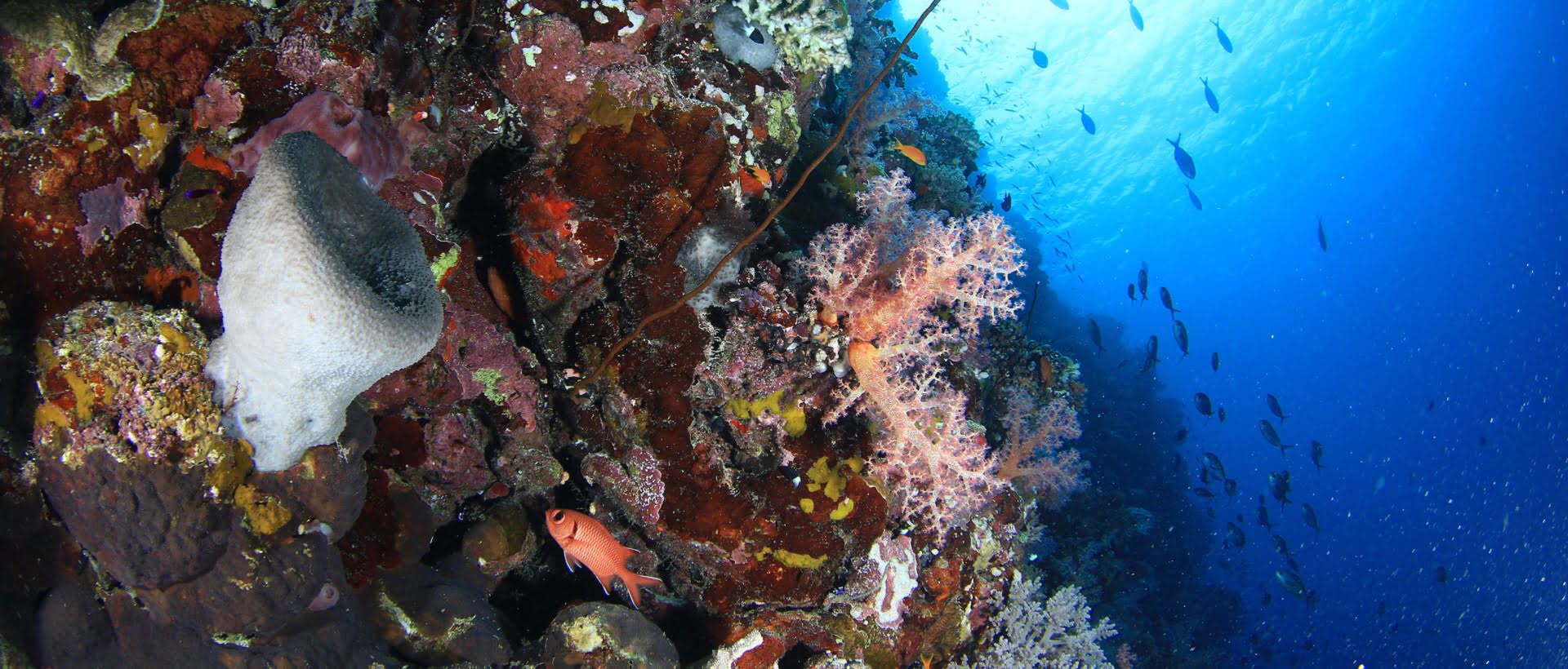
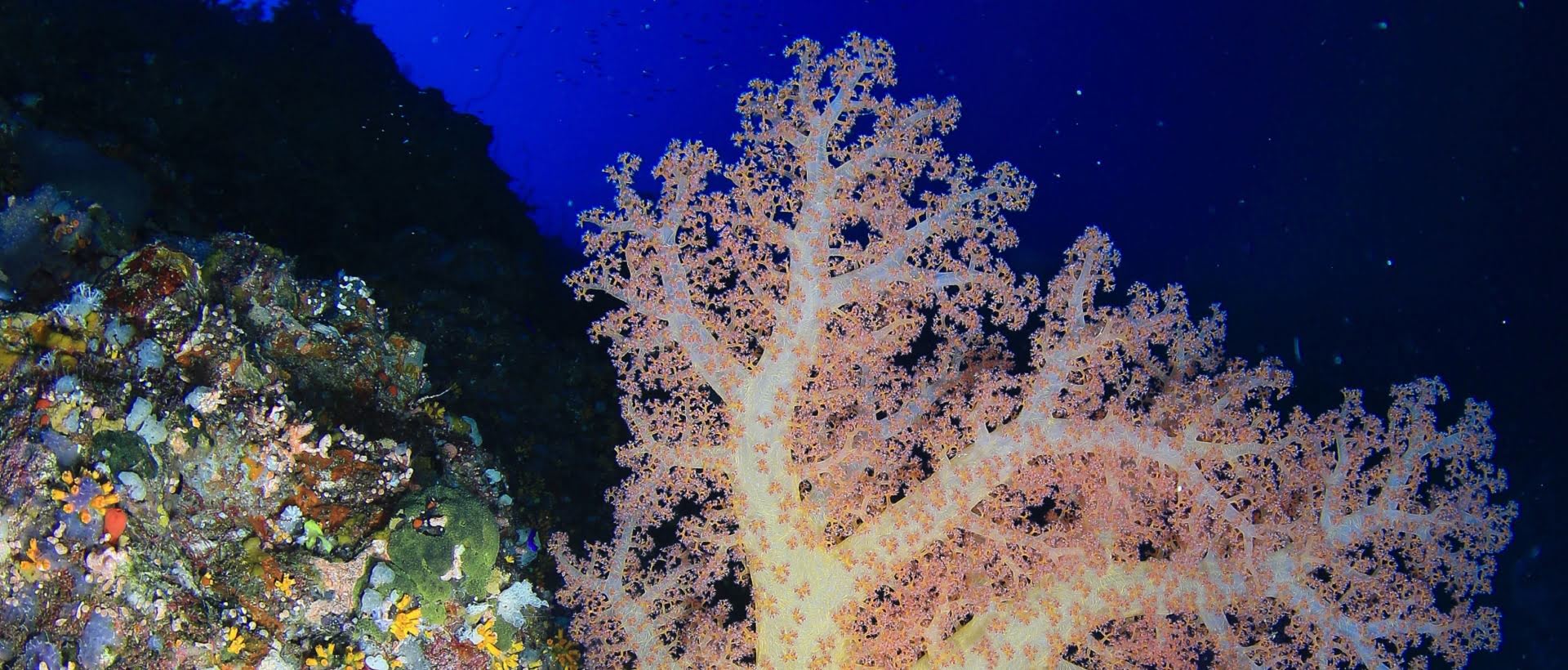
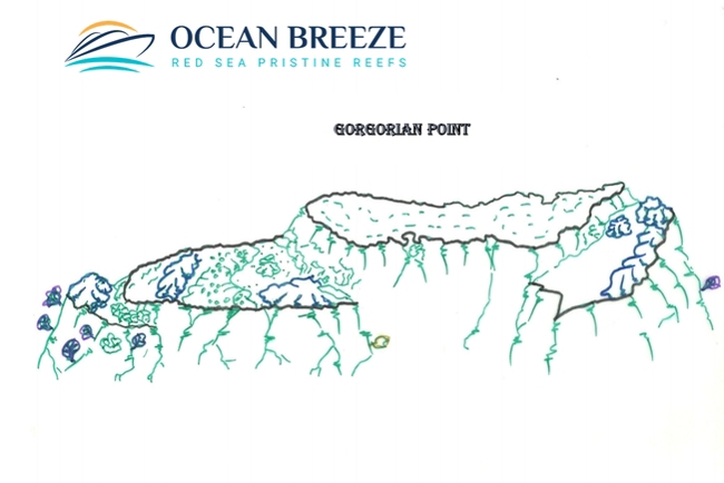
The long south-facing plateau slopes down from 25 meters deep close to the main wall up to 38 meters near the first point. Characterized by spectacular grape coral formations that cover most of its surface and by small, very colorful madreporic towers, the dive of Gorgonia is certainly one of the most beautiful and evocative of the whole Farasan Banks area. Consistent schools of fusiliers and reef fish are present everywhere while a school of barracuda is stationed above the plateau. Following the plateau in a southerly direction, on the west bank, you will encounter fans of gorgonians that rise vertically towards the surface. At a depth of 38 meters, you will encounter a narrow crack in the rock, and immediately after the tip of the drop off beautifully covered with gorgonians and Alcyonacea. This is the point where the current beats most where it is easy to come across substantial schools of jacks. A small but evident sandy channel leads to the second smaller plateau located between 45 and 50 meters from the bottom of which numerous whip-shaped madrepores rise. Specimens of gray sharks are stationed under the tip. The whole wall from 30 meters down is completely colonized by large fans of gorgonians and large soft corals. At the end of the bottom time, if the current conditions allow it, you can return by swimming along the plateau and cross it until you reach the main reef wall where this beautiful immersion full of suggestions ends.
Farasan Banks Diving Adventure
Embark on an unforgettable Red Sea diving adventure in Saudi Arabia with Ocean Breeze Liveaboards, starting from Al Lith Port, just 210 km south of Jeddah. In spring, divers can encounter families of whale sharks feeding on plankton near the harbor. After a short 3-hour sail, explore pristine Farasan Banks diving sites, where vibrant coral reefs and untouched underwater worlds await.
Dive into spectacular locations like Mar Mar Island, a stunning site perfect for night mooring, alongside nearby islands Dohra, Jadir, and Malathu, and the breathtaking reefs of Gorgonia, Bandu, and Long Reef. Venture 25 km south to the horseshoe-shaped Sha’ab Ammar, ideal for night anchoring, or explore the coral atolls of Danak, Jabbara, Eagle, Mudarr, Fantasy, and Choppy. These Red Sea diving sites teem with hard and soft corals, thriving plateaus, and schools of reef and pelagic fish, including hammerhead sharks and occasional tiger sharks along the north and south drop-offs.
Continue to the pristine reefs of Mubarak and Marbat Al Khail, bursting with vibrant marine life. Conclude your Saudi Arabia diving safari at Canyon Reef, a magical dive site offering an extraordinary experience. Book your Red Sea diving package with M/Y Almonda today and discover the wonders of Farasan Banks diving!
What do you expect to see?
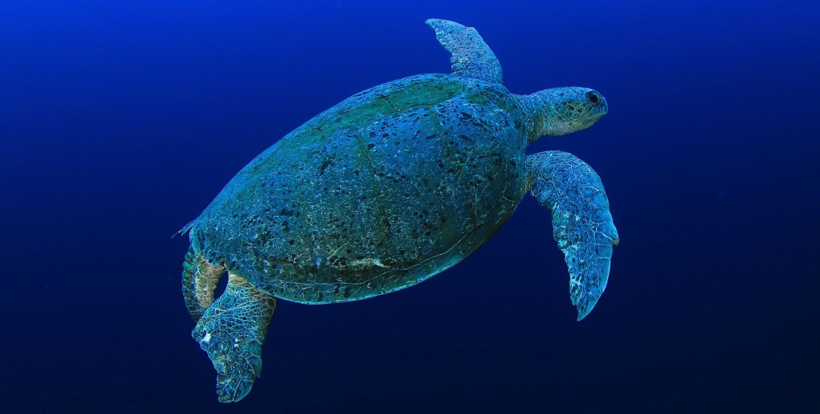
- Farasan Banks is an area of virgin reefs and wild islands, a kingdom of ospreys and gannets; where turtles lay their eggs. Uncontaminated seabeds inhabited by all kinds of marine animals and walls that rise vertically from the depths are the scenario that presents themselves when you dive at Farasan Banks. You are expected to see whale sharks, hammerheads, reef white, reef black tip, turtles and a variety of hard and soft corals.
Dive Sites
General Description:
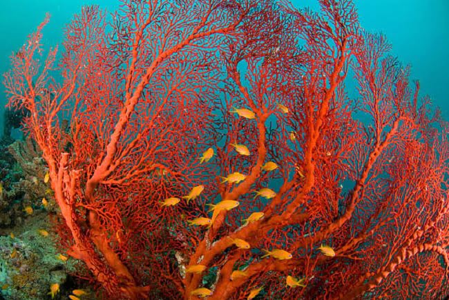
The Choppy Reef is exposed in a north-south direction and has a splendid internal lagoon with emerald water on the extreme north side, while at the center of the reef there is a small sandy island in formation that emerges according to the tide. Choppy Reef is located a few minutes sailing southeast from Danak Island.
Distance from the coast: 64 kilometers
Current: average probability
External: reef site isolated
Visibility: from medium to good
Very extensive submerged site - elongated
Difficulty: medium
Beginning of the plateau dive
Black coral interest, colored sponges
South: southeast side
Pelagic life: barracudas, trevally
Average and max depth: from 27 to 45 meters
Night: no diving is allowed at night
The best hour in the: morning
Snorkeling: along the east wall
Diving:
On the southern end of the reef, there is a narrow plateau with a sandy bottom at a depth of -25 meters. At its outer edge, there is an extended formation that forms a sort of belt, after which, one is faced with a vertical fall which in its final part creates a large recess in the wall. At a depth of -45 meters, there is the second plateau of much smaller dimensions than the first that slopes down to -55 meters. On the wall below the second plateau, there are black coral bushes of disproportionate size, some of which are covered with particular colored sponges that hang from the stems of the black coral like real clusters. After crossing the two plateaus, swimming with the wall on the left, you reach the southeast side of the reef which is characterized by an impressive concentration of abundant black coral “bushes”. The bushes are present anywhere from -10 meters deep down and are for the most part decorated with colonial sponges and sea squirts of all colors that seem to seep into the blue. The vision of these particular sponges and sea squirts, typical of the Farasan Banks area, will leave you amazed as it is a concentration that has not been found in any of the other dives in the area. Among the black coral bushes, you will be able to observe well-hidden specimens of hawkfish. Diving along the wall is fun as it is particularly heterogeneous, thanks also to the countless horizontal cracks that form small ravines with a sandy bottom inside, where you can meet small reef sharks resting on the bottom. Several large, colorful pinnacles detach from the main wall.
General Description:
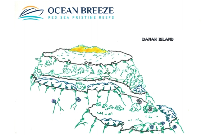
Danak Island is approximately 3.5 hours by boat southwest of Al Lith port and 6 kilometers south from Sha'ab Ammar. The central part of the island is covered with dense vegetation, where colonies of gannets find shelter that nest there during the winter while specimens of pelicans are sighted along the shoreline. The sandy beach that surrounds the island is the destination of turtles that lay their eggs.
Distance from the coast: 68 kilometers
Low probability current
External site: reef outcrop on the island edge
Visibility: from good to excellent
Submerged site: medium, elongated plateau
Difficulty: medium
Beginning of the dive: sandy madreporic plateau
Coral interest: alcionari, gorgonians, sponges
Pelagic life: trevally, turtles
Average and max depth: from 20 to 35 meters
Night: no diving is allowed at night
Best: time central hours
Snorkeling: yes
Diving:
The north side of the island is characterized by an extensive plateau with the base at a depth of 25 meters on which several madreporic towers rich in coral fish and small invertebrates thrive. On the base of the plateau, it is easy to meet specimens of turtles present almost everywhere. Trevally formations swim in the blue. The terrace is surrounded by a coral belt that delimits the fall on the external side of the wall. Some channels lead directly to a second plateau at -35 meters on which rows of whip gorgonians thrive and where you can meet specimens of reef sharks. Smaller in size than the first, it is also surrounded by coral blocks that separate it from the outer wall which then falls vertically.
General Description:
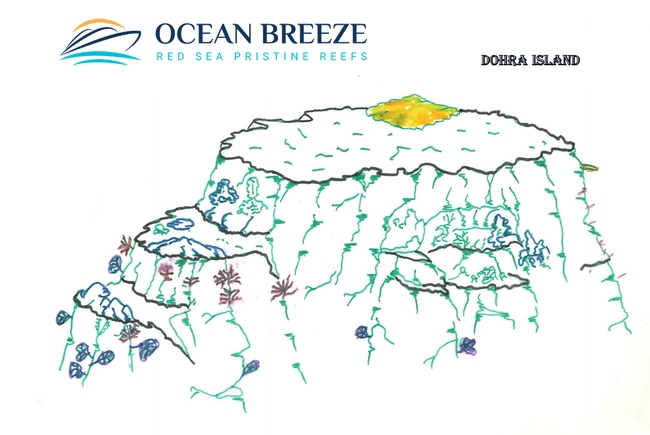
The island of Dohra, also called Turtle Island, is exposed in a north-south direction, has a flat profile and the central part is covered with scrub vegetation. On the east side, the holes where the turtles lay their eggs are clearly visible. White sand surrounds the whole island. Presence of gannets and peregrine falcons. On the north side, there is a small internal lagoon where specimens of herons are stationed.
Distance from the coast: 59 kilometers
Current: average probability
External site: reef outcrop on the island edge
Visibility: from medium to good
Submerged site: extended, elongated plateau
Difficulty: medium, demanding
Beginning of the dive: on a sandy plateau
Pelagic interest: soft corals, gorgonians
Pelagic: hammerheads, trevally, turtles
Average and max depth: from 20 to 40 meters
Night: no diving is allowed at night
Best during hours of the morning
Snorkeling: no
Diving:
The north plateau of Dohra composed mainly of light sand is wide and rests at a depth ranging from 30 to 40 meters. On the west side of the plateau, there are 2 huge coral blocks lined with coral and inhabited by coral fish that from the base extend up to 15 meters from the surface. Between the main wall and the two coral columns, there are narrow valleys where the current flows; these are also the points where multitudes of coral fish swim among small gorgonians and alcyonarians. Reaching the tip which is 40 meters above sea level, a madreporic spur is clearly visible on the wall at about 65 meters covered with whip gorgonians, a little further on there is a small rock resting on the bottom. We are at the point of greatest current where it is possible to meet the schools of pelagics, in particular trevally that stationed between the fall of the wall and the coral spur in depth. In the blue, it is possible to meet a large specimen of a solitary hammerhead shark. Continuing for about fifty meters with the main wall on the right, you will come across a sandy corridor that slides directly into the blue, going up it to reach the plateau again. A few meters separate us from the main wall facing east covered with beautiful hard coral. Swimming with the wall on the right you will come across a vertical wall covered with small colored alcyonarian. About a hundred meters after leaving the plateau and following the vertical wall, in depth a series of large caves are formed which from 30 meters reach the bottom to 60 meters deep. We are at the end of the dive and the caves can only be seen from above.
General Description:
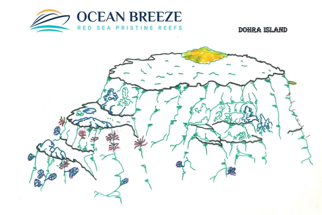
The island of Dohra, also known as Turtle Island due to the dense presence of turtles that lay their eggs, has a flat profile and its central part is covered with shrub vegetation. Along the whole beach that surrounds it, there are showy holes dug by turtles. Among the shrubs, there are osprey and boobies’ nests.
Distance from the coast: 59 kilometers
Current: average probability
External site: reef outcrop on the island edge
Visibility medium: from medium to good
Submerged site: small, circular plateau
Difficulty medium: medium
Beginning of the plateau dive
Interested: in soft corals, madrepores, sponges, caves
Pelagic: barracudas, trevally, tuna, turtles
Average and max depth: from 25 to 35 meters
Night: no diving is allowed at night
Best: morning time, central hours
Snorkeling: along the wall
Diving:
Descending at the south-facing slope, there is a small plateau at a depth of 28 meters covered by a rich garden of madrepores, whip corals, and colored soft corals. Groups of surgeonfish and other reef fish swim in the blue while schools of trevally mingle with tuna present in the points of the greatest current. Continuing beyond the ridge near the extreme tip, there is a second plateau at about 40 meters, smaller in size with a channel that leads to the external fall. At a depth of 60 meters, a rock can be seen resting on the bottom, which is also covered with beautiful gorgonians. Given the excessive depth, it will be possible to observe it from above, making sure that something interesting can appear from the blue. The dive continues following the southeast wall on the left; immediately after the plateau, for about fifty meters the wall suddenly becomes bare but, as if by magic, it magically becomes covered with so dense soft corals as to leave little room for hard corals. At the end of the bare wall area, there is a deep crack that opens vertically towards the bottom. A little further on there is a large ravine at 15 meters, about 30 meters long with a light sand bottom. The ceiling is covered with small gorgonians. It is easy to meet small sharks resting on the bottom. At the exit on the right, there is a pinnacle with soft corals, gorgonians, and colonies of black coral.
General Description:
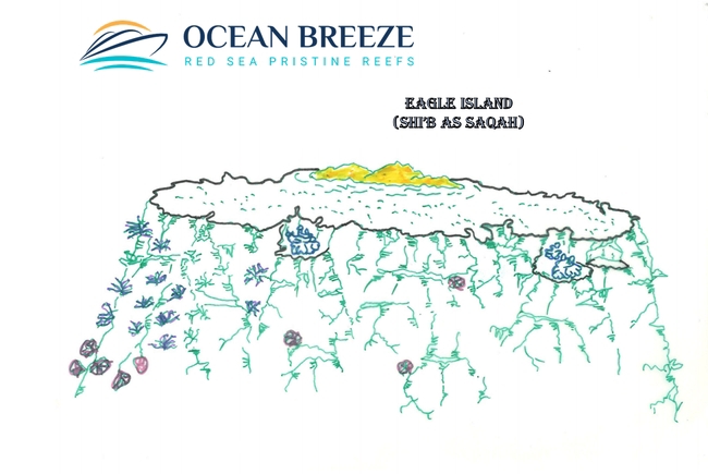
About 30 minutes south of the island of Jabbara is Saqah Island, a beautiful islet that, observed from a distance, vaguely recalls the Maldivian islands. Unlike the islands previously encountered, Saqah Island is special thanks to its predominantly green surface but above all the island is surrounded by an internal emerald green lagoon. Inside the island, in addition to the usual birds, there are several examples of osprey.
Distance from the coast: 50 kilometers
Low probability current
External site: reef outcrop on the island edge
Visibility medium: from medium to good
Extended submerged site
Difficulty: medium
Beginning of dive: in the madreporic wall
Interesting soft corals, black coral, ravines
Pelagic: trevally, tuna
Average and max depth: from 15 to 50 meters
Night: no diving is allowed at night
Best: time morning, central hours
Snorkeling: no
Diving:
The descent into the water takes place at the exposed plateau on the southern side of the island. Going down directly into the blue you reach the first plateau at -30 meters (about 50 meters wide) composed of white sand and small coral formations. Swimming towards the tip leads to the fall that leads to a second small plateau at a depth of -50 meters where there are formations of gorgonians in rows. A quick glance into the blue from where shoals of pelagics may appear and then continue for a short distance with the wall on the left. A little further on, there is a long white sand channel that leads to an extended terrace at -25 meters on which large coral blocks are covered with gorgonians and small alcyonaria rest. At this point, it is easy to meet a contrary current that can be countered by sheltering between the towers but it will be thanks to the current that specimens of tuna, trevally, and other pelagics can appear from the blue. Considering the intensity of the current it will not be possible to spend too much time but this will be enough to realize the quantity of fish. At the end of the stay time, the dive will continue by swimming with the main wall on the right. We will swim inside a sandy channel that runs parallel to the main wall. At some point, you will encounter a series of large coral blocks that penetrate the reef. We are at a depth of -15 meters where the light that filters through the coral creates magical scenographies by modeling every little detail of the rock. The presence of rabbitfish is impressive. We are at the end of the dive and we will spend all the remaining time swimming between the towers.
General Description:
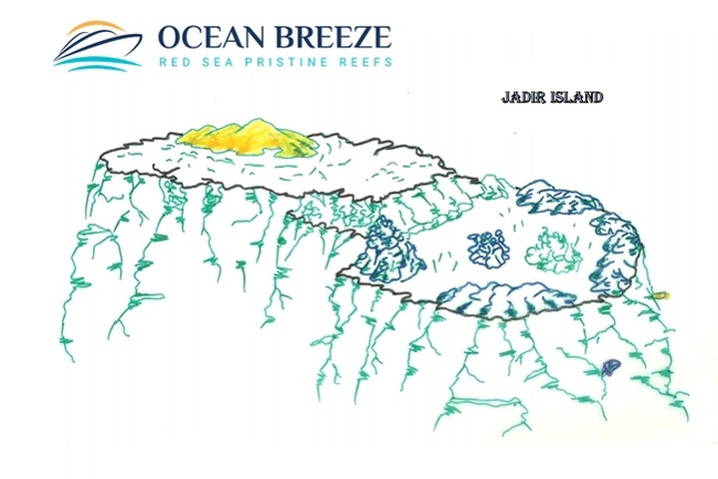
The island of Jadir is located approximately 2.5 hours from the port of Al Lith. Small, flat, and sandy, it has little vegetation in the central area. Much beaten by the turtles who use these land to lay their eggs.
Distance from the coast: 56 kilometers
Low probability current
External site: reef outcrop on the island edge
Visibility: from low to medium
Extended semi-circular submerged site
Difficulty: simple
Beginning of the dive: on a sandy plateau with coral towers
Interested: in coral fish, hard coral, caves
Pelagic: turtles
Average and max depth: from 20 to 35 meters
Night: no diving is allowed at night
Best time: afternoon
Diving:
The long exposed plateau on the north side of the island of Jadir has a large boulder on the east end close to the main wall where a narrow channel is formed that leads into the blue. The plateau that follows the whole north side is characterized by isolated rocks lying on a light sand bottom between 25 and 30 meters deep. It is easy to meet the turtles that go to lay their eggs on the island during the night. Slightly extended towards the outside, the plateau is delimited by the typical madreporic belt that takes the whole view in blue. There are several sandy channels that lead to the external fall of the wall which is quite bare with some small terracing in-depth and isolated gorgonian formations over 40 meters. Numerous channels are present at depths ranging from 30 to 40 meters. Following the exposed walls on the eastern and western slopes, the hard coral formations intensify, which in some places are absolutely extraordinary for the variety of hard coral formations. The considerable presence of coral and sea floor fish can be observed in the layer of the reef. In the terminal part of the wall facing west, there are large caves and a dense presence of anemones. The eastern wall is characterized by several pinnacles with the cap at 15 meters covered by huge formations of anemones. Coral is intact everywhere.
General Description:
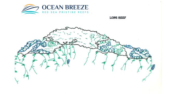
Long South Reef, so named for its elongated shape, is located 2 kilometers south of Mar Mar Island and a few minutes away from the main dives of the North Banks area. Easily recognizable by its characteristic elongated shape with the tips facing north and south, it is located just north of the island of Malathu. In the area inside the reef, some small "pools" with turquoise water are clearly visible.
Distance from the coast: 56 kilometers
Current: high probability
External: reef site isolated
Visibility: from good to excellent
The very extensive submerged site, elongated
Difficult: challenging
Beginning of the dive: in the madreporic plateau
Coral interest: soft corals, hard coral
Pelagic: gray sharks, hammerheads, barracudas, trevally
Average and max depth: from 15 to 45 meters
Night: no diving is allowed at night
Best time: morning, central hours
Snorkeling: yes
Diving:
From the anchor point, you reach the extensive plateau that slopes down from a minimum depth of 15 meters close to the wall, up to a maximum of 40 meters at the outermost point. Spectacular hard coral formations slope down from a depth of 15 meters and extend towards the plateau. A little further on, a wide sand channel forms parallel to the wall which separates from elevated “madreporic hills” which rest on a depth of 25 meters, covered with purple soft corals. After having passed them, you will come across a second channel at 35 meters to then reach the madreporic belt that bounds the outer ridge. Two large slits allow the exit into the blue. At the southern tip, at 56 meters, there is a small terrace covered with rows of gorgonians, a place where it is possible to encounter a current, even particularly intense. This is the best spot for sighting large pelagics. A large school of almost sedentary barracudas as well as groups of trevally and tuna are present in the points and moments of greatest current. Gray sharks swim close to the wall while a school of hammerhead sharks is found in the blue. After having spent the necessary time at the maximum depth, we return along the plateau following one of the corridors that lead to the main wall. Part of the time still available is used to swim and browse through the spectacular hard coral formations that create a sort of lunar landscape. Slowly you can then leave the plateau to reach the mooring of the boat.
General Description:
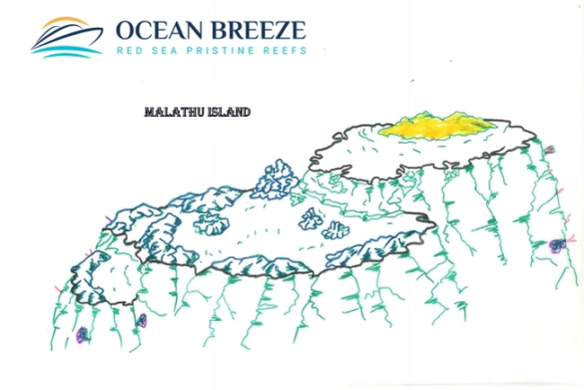
The island of Malathu appears flat and bare of vegetation, with a vaguely triangular shape. On the island, there are always numerous colonies of birds. They lay their eggs in the winter months. The month after spawning, the island is filled with small chicks and a multitude of eggs scattered everywhere. On the southern side, the "beach rocks" alternating with enchanting fine white sand is clearly visible, ideal for laying turtles' eggs.
Distance from the coast: 59 kilometers
Current: average probability
External site: margin of the island
Visibility: from good to excellent
Extended submerged site: circular
Difficulty: medium to demanding
Beginning of the dive: on a sandy, madreporic plateau
Pelagic: gray sharks, hammerheads, silk, barracudas, trevally
Average and max depth: from 25 to 35 meters
Night: no diving is allowed at night
Best time: anytime
Snorkeling: no
Diving:
On the southern side, there is a long surface reef that extends from the island for about 200 meters until it reaches the wall that descends on the wide plateau at a depth of 30 meters characterized by some madreporic towers. Swimming in a south-westerly direction, taking as a reference a narrow sandy channel that cuts perpendicular to the terrace, you reach the drop-off, not before having passed a belt of low madreporic hills that surround the ridge. An evident rocky block separated from the wall that falls perfectly vertical is also the point where the current beats most. Leaning on the bottom at a depth of about 80 meters, there is an obvious isolated madreporic block, absolutely to be kept as a reference only! We are at the point where it is easier to observe the large pelagics, particularly hammerhead sharks, gray sharks, and silky sharks. At the end of the time dedicated to the sighting of pelagics, we return following the plateau in a direction towards the main wall not before having encountered schools of jacks, barracudas, solitary turtles, and all that a sea so rich in such a favorable point can bring.
General Description:
Positioned between the island of Danak to the north and that of Jabbara to the south, the reef of Mudharr looks like an extended madreporic conformation of elongated shape facing north-south, inside which there is a small sandy island in formation. A large herd of dolphins is often sighted close to one of the two slopes most exposed to the surface current.
Distance from the coast: 48 kilometers
Current: average probability
External: reef site isolated
Visibility: from medium to good
Submerged site: medium, circular plateau
Difficulty: medium, demanding
Beginning of the dive: in the madreporic plateau
Pelagic interest: gorgonians, sponges, caves
Pelagic: gray sharks, hammerheads, barracudas, trevally
Average and max depth: from 25 to 40 meters
Night: no diving is allowed at night
Best time: central hours, afternoon
Snorkeling: no
Diving:
Going down on the north-facing plateau at 35 meters, one encounters isolated madreporic conformations combined with channels of clear sand that rest on a large, relatively bare clearing. The external slopes are boundedby a large madreporic ridge that goes up to 25 meters covered with stony corals that surrounds the entire outer edge. A narrow sandy channel between two evident coral blocks leads directly to the drop-off, carpeted by fan-shaped and whip-shaped gorgonians, which falls vertically down to 57 meters. At this point the wall forms a wide spur and below, resting on the bottom at about 75 meters, there is an isolated boulder covered with gorgonians. On days when the current hits the tip, schools of barracudas and trevally are always present. Deep, behind the boulder, you can spot specimens of gray sharks and silky sharks but the real surprise can come from the blue where the hammerhead sharks will appear. Once the time in depth is over, go up along the external wall covered by fans of gorgonians and large formations of sponges until you reach the channel that allows you to go beyond the madreporic belt, cross the plateau to return directly to the main wall where you continue the dive along the east side that falls vertically and is interrupted from time to time by deep cracks that creep inside forming large caves. The multitude of gorgonians observed before gives way here to soft and colorful soft corals. Also interesting is the top of the surface reef which, in a few meters of water, allows you to observe the rich marine life.
General Description:
Located just over 3 hours by boat north of the Farsan Banks, the two islands indicated on the nautical map with the name of Qadd Humais are positioned 22 kilometers west of Marsa Qishran and about 40 kilometers north of the island of Mar Mar. The two islands are actually huge tongues of fine white sand that lengthen or shorten according to the tide. Surrounded by a large coral platform extending from north to south, they represent two isolated jewels in the middle of the sea. The island of Qadd Humais is the one located further south just a kilometers away from the first island.
Distance from the coast: 35 kilometers
Current: average probability
External: reef outcropping site
Visibility: from medium to good
Very extended submerged site
Difficulty: medium
Beginning of the plateau dive
Interested: in coral fish, alcyonarian, sponges, nudibranchs
Pelagic: turtles, stingrays, manta rays, barracudas
Average and max depth: from 27 to 45 meters
Best time: morning and central hours
Snorkeling: no
Diving:
The southern side of the reef has a large plateau with a sandy bottom at a depth of 30 meters and is characterized by a multitude of coral towers completely covered with small colored soft corals. The long external wall of the plateau is an explosion of fans of gorgonians, soft corals of a thousand colors, and bushes of black coral. In optimal conditions, walk along the outer wall for a short distance keeping it on your left, where you will reach the maximum depth of 45 meters; along this path in the blue, it is quite usual to meet some specimens of manta rays that swim in this stretch of sea rich in plankton. At a certain point, you come across an evident madreporic spur flanked by a wide sandy channel that leads directly into the plateau. The whole edge that bounds the plateau is surrounded by a madreporic belt that rises a few meters from the bottom, which is also covered with colored corals. It is therefore worth swimming for a while on the surface of the coral ridge to admire its beauty and its integrity, after which you can dedicate yourself to the discovery of the countless towers that will leave you amazed by their richness. Among the multitudes of towers, there are more or less wide sand channels where it is easy to meet large specimens of stingrays resting on the bottom and above all myriads of coral fish present everywhere. Each tower has different characteristics from the previous one and each of them will be a discovery. This dive does not offer the vision of the big pelagic fish therefore it is not recommended to spend time looking for it while you will have to focus your attention on smaller but equally suggestive animals such as the variety of nudibranchs present almost everywhere.
General Description:
The submerged reef called Twenty Miles is located halfway between the island of Mar Mar and Gorgonia reef. Today Twenty Miles has become by all rights one of the unmissable dives during a cruise to the Farasan Banks.
Distance from the coast: 59 kilometers
Intense possible current
Submerged reef external site
Excellent to medium visibility
Small circular submerged site
Difficulty: medium
Start diving at the wall
Pelagic and coral interest
Pelagic: sharks
Average and max depth: from 12 to 45 meters
Night: no diving is allowed at night
Best time: in the morning
Snorkeling: no
Diving:
The Twenty Miles site is the classic, perfectly circular madreporic tower with the hat placed at a depth of 10 meters with a surface diameter of about 50 meters. The first coral cone falls vertically to a depth of 30 meters and then meets a sandy ring that surrounds it for its entire circumference. Several large madreporic blocks lie on the sandy bottom, alternating with large formations of grape coral. On the southern side, the sandy channel widens to extend towards the blue where it forms a double terrace of which the second at about 45 meters with square-shaped coral blocks lying on the sand bottom. This is the point of greatest current where it is easy to meet large pelagics including gray sharks, large trevally, and tuna. After the time in-depth, follow the wall, going around it in a spiral to enjoy the beautiful coral wall, swimming among a myriad of fusilier fish and schools of sardines. The dive ends at the top of the reef where clouds of anthias pulsate like a lung. Twenty Miles diving can only be done in calm sea conditions.
General Description:
Jabbarah Island
General Description:
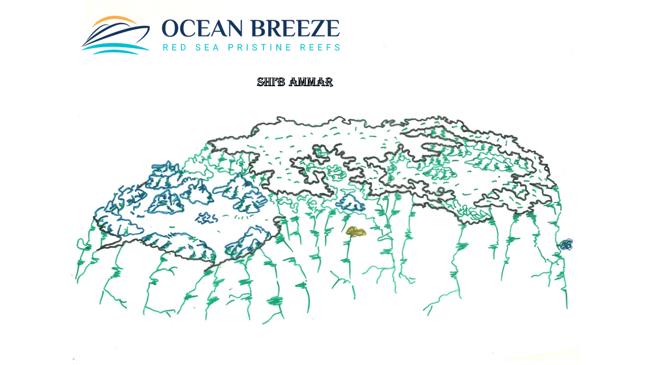
Shi'b Ammar
Included
- Airport and hotel transfers
- Nitrox for certified divers
- Night dives
- Complimentary toiletries
- Cabin, beach and dive deck towels
- Laundry and pressing services
- Wi-Fi Internet where signal is available
- Stand up paddleboard
- Full-board meal plan (all meals)
- Snacks
- Soft drinks, tea, coffee, mineral water
- National park fees
- Fuel surcharge
- Port fees

Excluded
- Entry visa
- Gratuities (80 USD per person per trip)
- Land excursions
- Scuba diving courses
- Rental gear
- Alcoholic beverages (Not Available in Saudi)
- International and local flights
- Travel and dive insurance
